
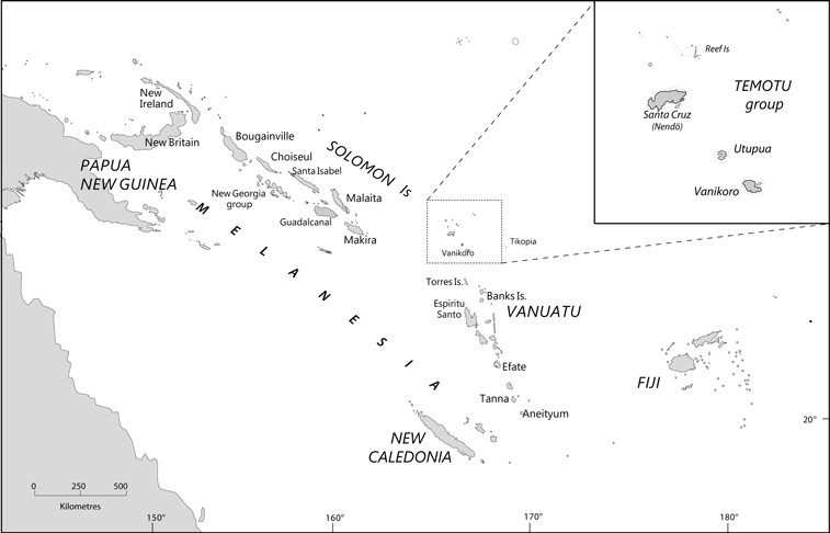
The island of Vanikoro
Part of my research was conducted not in Vanuatu, but in the neighbouring Solomon Islands — more precisely, in the island of Vanikoro [see my story here].
With its 193 sq. km, Vanikoro (locally known as Banie) is the second largest island in the small archipelago formerly known as the Santa Cruz Islands, and now often referred to as “Temotu”, after the official name of the easternmost province of the Solomon Islands. It is located very far from the main island chain of the Solomon archipelago, and is geographically much closer from the northern islands of Vanuatu.
© A. François
Languages on Vanikoro
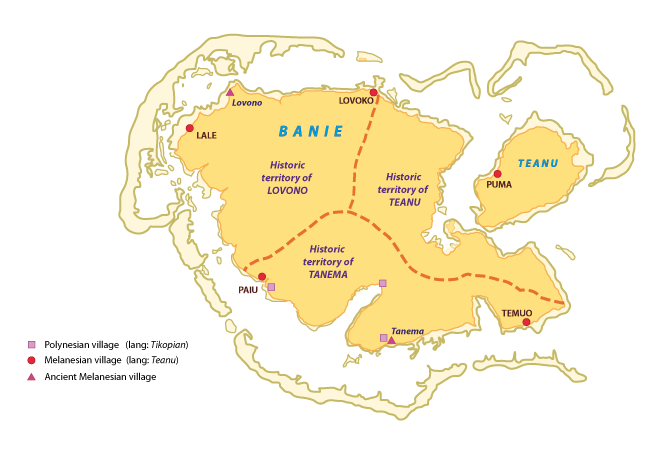
The 900 inhabitants of Vanikoro consist of about 300 Polynesians originating from Tikopia, and 600 Melanesian islanders. The latter used to be distributed into three distinct tribes or ethnic groups speaking distinct languages: Teanu, Lovono, and Tanema.
Although they merged into a single population during the 20th century, islanders nowadays still remember the precise limits of each tribe's historical territory. [see map] The whole Melanesian population of the island now speaks Teanu: the two other languages are only remembered by a handful of last speakers. [for more detail see here and here]
 © A. François |
Vanikoro placenames
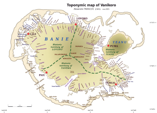
Part of my work, during my 2005 fieldwork in Vanikoro, was to collect traditional placenames. The result of this work appears in this third map.
© A. François


